hurricane irene
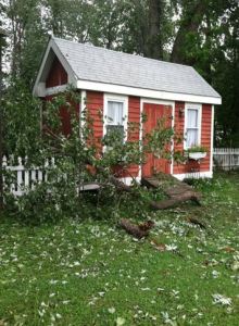
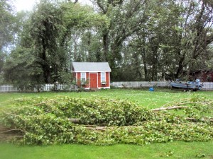
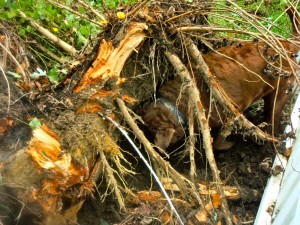
 We interrupt this hurricane blog to bring you a fishing report. Yes, this IS a website dedicated to light tackle fishing, and on most Sunday evenings, that’s what I do. I spent most of the day singing the lumberjack song with chainsaw in hand, cutting up the trees and limbs that fell in our yard. After seeing all the trees down around Kent Island today, I’m surprised that we didn’t have more damage than we did. We are also fortunate that the only complete tree that was uprooted in our yard fell harmlessly instead of taking out our picket fence or part of the church next door. We worked on the house and yard most of the afternoon, finishing about 5:00 PM. That left just enough time to go fishing.
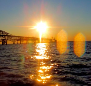
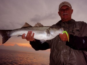
I launched Thunder Road at Matapeake and ran north to the Bay Bridge. Winds were about 12 knots out of the west when I started, but came down to near zero as the evening wore on. The water was stained, but not as much as I expected. Water temperature and air temperature were exactly the same at 76 degrees. That’s significant because the water has been well into the 80s. It means there was a lot of top-to-bottom mixing due to the storm. I did expect the fish to be freaked out and hunkered down, and they were. I gave the Bay Bridge a good shot, but only caught one little rockfish. I thought the fish might be deep, so I started my fishing trip looking for more of a winter pattern. I marked a few fish deep, but I couldn’t get them to bite. I moved to the shallow pilings and there wasn’t anything going on there either. Read More!
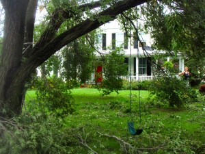 Most of the damage here on the island came from falling trees. Since the wind is still gusting into the 40 mile-per-hour range, and the ground is completely saturated, more trees could fall. I’ve heard of a few houses and stores that were hit by flying debris, tree limbs, etc. but it sounds like most of the island came through the storm fine. UPDATE: 12:36 PM – One confirmed death in Queenstown due to a falling tree leading to a chimney collapse. We lost power here in historic Stevensville at 10:14 PM, but it was back on at 9:00 AM.
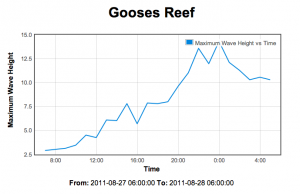
Since the storm stayed off the coast and winds have stayed from the northeast, a storm surge never materialized, but there were some very big waves on the Bay. I’m attaching a graph from the Gooses Reef Buoy. A giant 29-foot wave was recorded by First Landing Buoy at the mouth of the Bay near Cape Henry. That may be the biggest wave ever recorded for the Chesapeake.
I will eventually get out and look around, 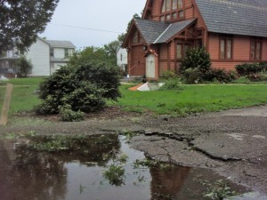 but I think it’s wise to keep the roads clear for emergency vehicles and highway crews right now. We still hear sirens from time to time. The Bay Bridge has reopened under Phase II wind restrictions. Here’s some shots of our house and the immediate area.
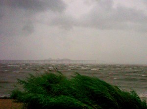 The Bay Bridge is now closed due to sustained winds of 62 miles-per-hour and gusts from 72 to 80 miles-per hour. That was at 7:30 PM and the wind continues to build. We’ve lost a few big limbs from trees around the house, and we can hear trees coming down back behind our fence and around the neighborhood. The power has blinked a few times, but has fortunately stayed on. The center of the storm is now back over water and looks to be directly between Cape Henry and Cape May at the mouth of the Chesapeake Bay moving north toward Ocean City, Maryland. That’s still well to our south, so we have lots more to come.
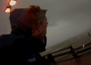
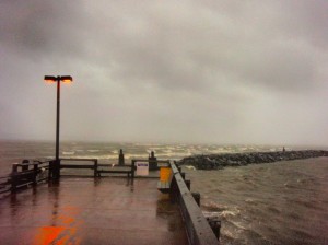 Despite the conditions, I couldn’t resist a hike around the area to watch the storm. It was quite an adventure. I visited Matapeake Pier and the beach at Terrapin Nature Area. Winds were sustained at 50 knots while I was out. I was surprised to see the Bay so rough even though this side of the island is protected from the northeast winds. I’m sure things look a lot more dramatic on the western shore. There is no storm surge at this time. I’m feeling a lot better about that since winds are now pushing water out of the Bay instead of in. I shot a few minutes of video while I was out. For some reason it doesn’t want to embed, so click here or on the photo if you can’t see it: Hurricane Irene, Kent Island, Maryland
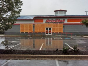
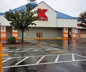
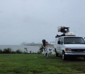 It started raining on Kent Island about 8:30 AM, and has been coming down steadily since. The wind is coming up now, but it’s still little more than a rainy day here. As of 1:00 PM, wind speeds are 22-knots from the northwest at Thomas Point Light House near Annapolis, and 34-knots at Point Lookout at the mouth of the Potomac River. I got out and drove around in the truck a few minutes ago. It is weird seeing all the businesses closed and buildings boarded up on what is usually a busy Saturday afternoon. It may have been a little over-cautious to require everyone to close so early today, but time will tell. A few more of our neighbors got out of Dodge this morning, but most are still around.
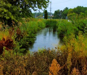 Traffic is light on Rt 50 and flowing smoothly across the Bay Bridge in both directions. I heard the directional lane signals are out for reasons unrelated to the weather. At this time, I see no evidence of a tidal surge. I’m attaching a photo of the tidal stream across the street from our house. (click photos for high rez) It’s my usual indicator of tide height. The charts show predicted low tide about now, so I’d say things look normal. I would guess we’ve had about an inch of rain so far. The ground is saturated from storms we had earlier in the week, so I expect we will see some flooding in the area regardless of storm surge.
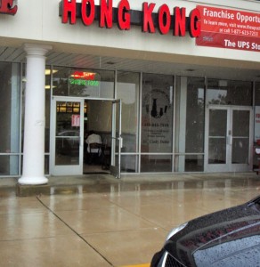
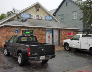
I saw two businesses open as I was driving around. They are Hong Kong Chinese Restaurant (our favorite) and No Place Bar & Grill (hmmm). I am taking this as a sign that God is on our side.
 Kent Island is currently under a state of emergency and a mandatory evacuation order. We have decided to ride out the storm since the house we live in – one of the oldest on the island – has survived its share of tropical weather. Most of our neighbors are also staying. I thought it might be interesting to pass along what we’re experiencing here on Kent Island as Hurricane Irene passes through. Reload this page frequently, as I will be posting regular updates along with pictures and video. Some storm trackers predict we are directly in the path of the storm, but most have it passing east of us, just slightly off the Coast of the Delmarva Peninsula. I’m hoping for the easterly path, but we are taking the warnings seriously. This is a fishing website, so most of my observations will be about the hurricane’s impact on the Chesapeake Bay. We don’t live right on the water anymore (thankfully), but we are less than a hundred yards from the closest tidal stream.
The Calm Before The Storm
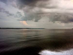 I fished last night and tonight. Every fisherman has heard about how good fishing can be before a storm. Since Hurricane Irene is predicted to be the worst storm in decades, I was hoping for lots of big fish. That didn’t happen. Oh, we caught plenty of fish, but they weren’t the big ol’ good ‘uns I was hoping for. Last night, Rich and I launched out of Matapeake and found breaking bluefish right out in front of the ramp. Finding no Spanish mackerel or rockfish of any side, we ran south. I guess we passed a half-dozen pods of breaking fish on the way, but all the fish were small. I eventually spotted some bigger birds sitting over a drop-off, so we motored over to take a look. There were no fish feeding on the surface, but the fish finder lit up so we started casting jigs. Read More!


